
Detailed analysis of all available seismic data from Saturday's 4.2 magnitude earthquake by the British Geological Survey shows that the epicentre was less than 1 km east of Folkestone and close to the area of maximum reported damage. However, uncertainties in epicentre determination are still of the order of 5 km. The event occurred at shallow depth, less than 5 km below the surface.
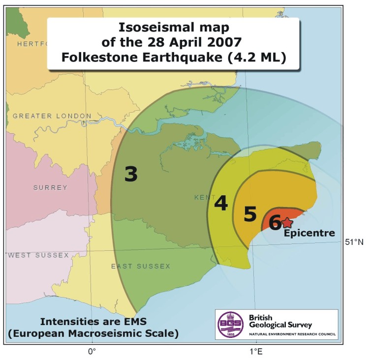
Members of the public were invited to complete an online macroseismic questionnaire to report the shaking and damage they experienced. Over one thousand replies have been received to our online survey. The final map of the analysed data can be viewed. The maximum intensity is currently assessed as 6 EMS (European Macroseismic Scale). This is the highest recorded intensity for a British earthquake in over 100 years. Acceleration levels at the nearest station (about 5km from the earthquake) were about 0.1g, also the highest recorded in the UK.
The worst damage is concentrated within one area of Folkestone. In the most affected group of streets, serious structural damage to a few houses was observed, including large cracks in load-bearing walls. There have been many cases of damage to chimneys, with fall of chimney pots and fall of brickwork from the upper part of the chimney stacks, with secondary damage to roofs from falling masonry. A detailed damage survey is being carried out by BGS. The damage seems to have been exacerbated by local site conditions. The BGS are installing a number of additional sensors in southeast England to study any possible aftershocks or further earthquake activity.
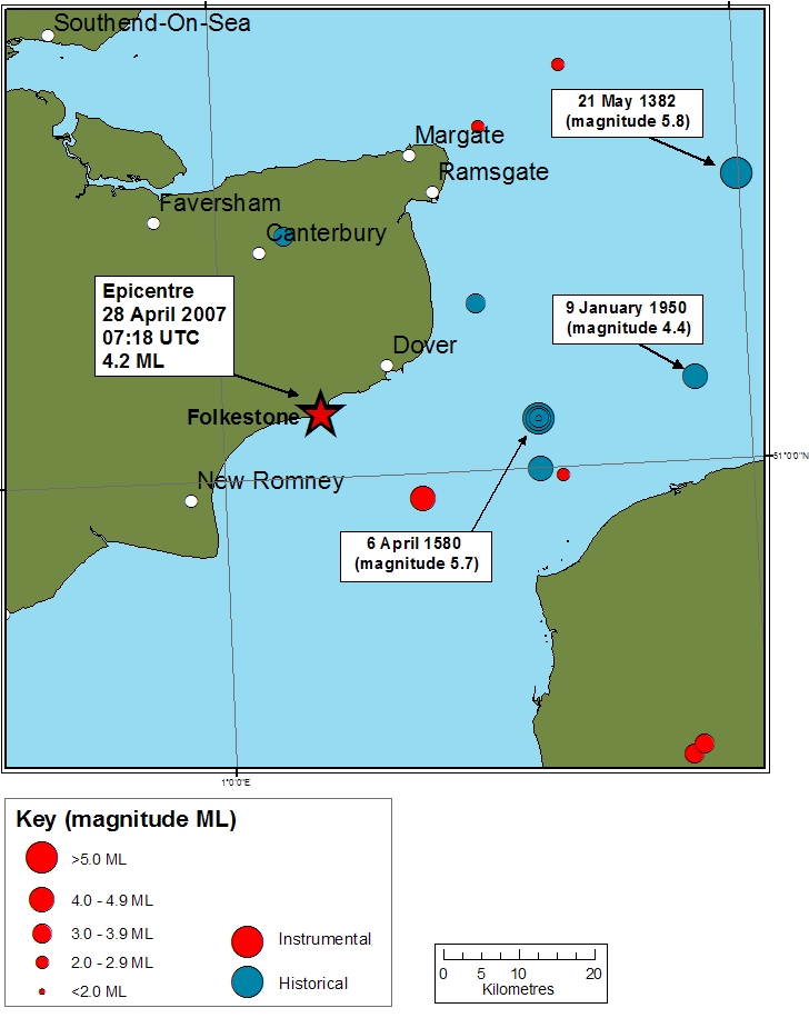
This is the largest earthquake in this region since a magnitude 4.4 ML earthquake in 1950. Significant earthquakes also struck the Dover Straits in 1776 and 1580; the latter had an magnitude of 5.7 ML and caused damage as far as London where two people were killed by falling masonry. Earthquakes of magnitude 4.2 ML occur in mainland UK roughly every 5 years although are more common in offshore areas. A magnitude 4.7 ML earthquake struck Dudley, West Midlands in 2002 and was widely felt across England and Wales.
Isoseismal map produced from results of the macroseismic survey.
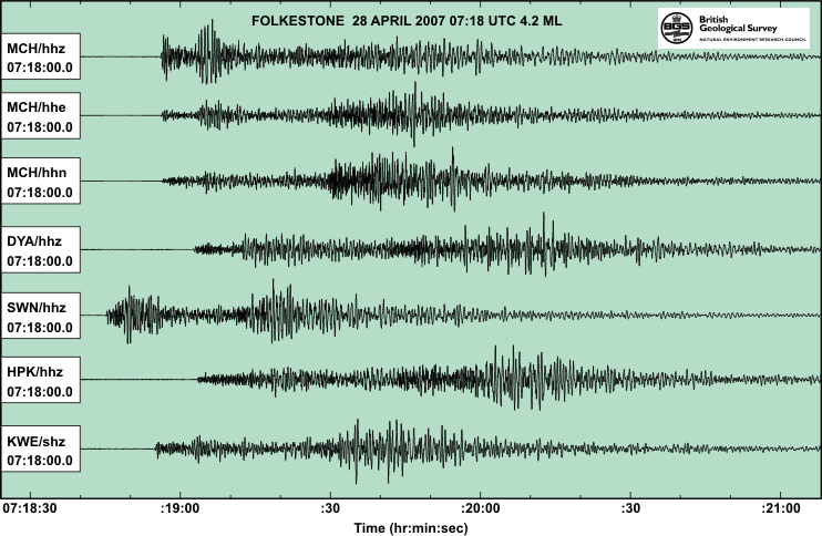
Seismograms of the Folkestone earthquake as recorded on the BGS instruments.
Map showing historical and instrumental seismicity (all magnitudes) within 50 km of the Folkestone earthquake of 28 April 2007 since 1382.
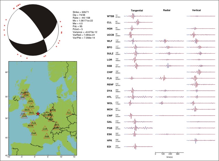
Moment tensor solution (top left) calculated using UK and regional broadband data (right). The solution shows a oblique normal mechanism with the nodal planes in either SSW-NNE or NW-SE direction.
List of Aftershocks (Locations are fixed to that of the main event)
| DATE | TIME | LATITUDE | LONGITUDE | DEPTH | MAGNITUDE |
|---|---|---|---|---|---|
| 28/04/2007 | 07:20 | 51.08 | 1.17 | 2.0 | 1.7 |
| 28/04/2007 | 07:24 | 51.08 | 1.17 | 2.0 | 1.1 |
| 28/04/2007 | 11:10 | 51.08 | 1.17 | 2.0 | 1.8 |
| 29/04/2007 | 06:51 | 51.08 | 1.17 | 2.0 | 1.4 |
| 01/05/2007 | 07:36 | 51.08 | 1.17 | 2.0 | 1.2 |
| 02/05/2007 | 21:50 | 51.08 | 1.17 | 2.0 | 1.7 |
| 02/05/2007 | 21:51 | 51.08 | 1.17 | 2.0 | 1.2 |
| 04/05/2007 | 07:01 | 51.08 | 1.17 | 2.0 | 1.3 |
| 05/05/2007 | 05:09 | 51.08 | 1.17 | 2.0 | 1.0 |
Issued 27 June 2007