Summary
| DATE | 18/08/1892 |
| ORIGIN TIME | 00:24:00 UTC |
| LOCATION | 51.700 -5.040 |
| DEPTH | 26.0 km |
| MAGNITUDE | 5.1 ML |
| LOCALITY | PEMBROKE |
| DATE | 18/08/1892 |
| ORIGIN TIME | 00:24:00 UTC |
| LOCATION | 51.700 -5.040 |
| DEPTH | 26.0 km |
| MAGNITUDE | 5.1 ML |
| LOCALITY | PEMBROKE |
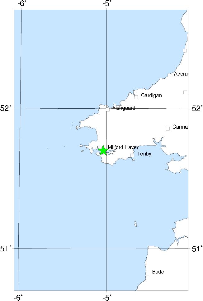

The area most affected by this earthquake was Wales and the Cornubian Peninsula, but the event was also felt in Ireland (principally in the SE) and weakly in western England. It was not felt further to the NE than Birmingham, though there is an isolated observation from Surrey. There was slight damage only in the epicentral area (one chimney, a few stones, some plaster), but disturbances to the water of Milford Haven were observed, also effects on springs. The epicentre was probably in Milford Haven.
There were a number of aftershocks, two of which are included in this catalogue. The largest was felt as far away as Knighton, St Austell and Wexford. It is difficult to get much information on the maximum intensity of these aftershocks, since most descriptions simply say that they were much less severe than the main shock. But neither of them seem to have been very strong, and the large felt areas, and therefore large magnitudes, are surprising. The magnitudes given here may be overstated.
Sources: Musson et al (1984a).