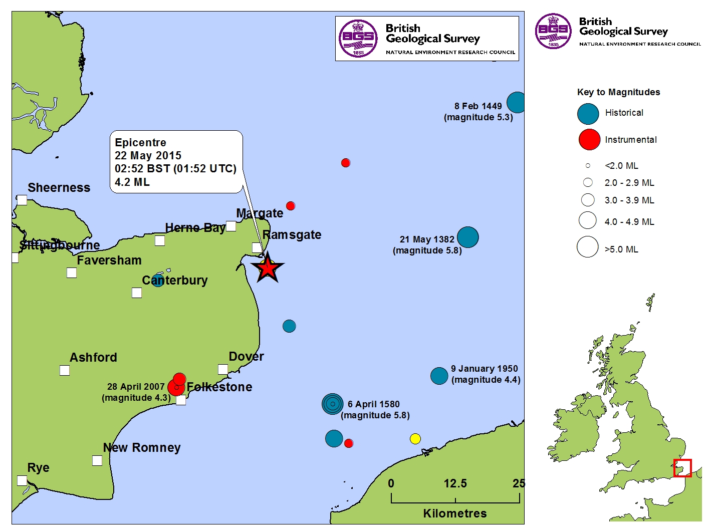
| DATE | 22/05/2015 |
| ORIGIN TIME | 01:52:17.8 UTC |
| LOCATION | 51.317 1.450 |
| DEPTH | 9.1 km |
| MAGNITUDE | 4.2 ML |
| LOCALITY | RAMSGATE |
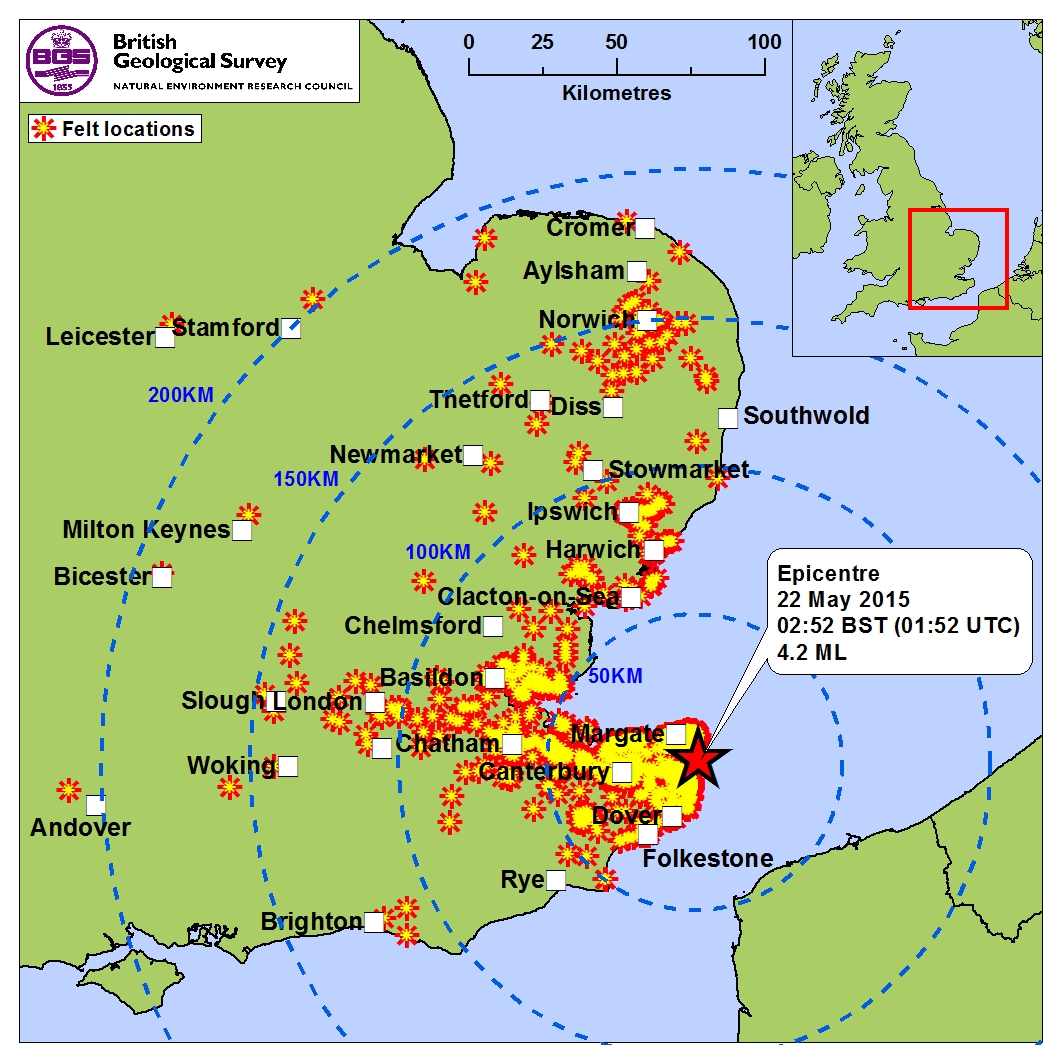
Over 1,600 reports from an automatic online questionnaire survey were received from members of the public, almost all of them coming from within a 75km radius of the epicentre, covering Ramsgate, Margate and their surrounding hamlets, as far south as Dover and Folkestone (approx 20-30km SW of the epicentre), Canterbury (25km west of the epicentre) and Herne Bay (20km to the NW of the epicentre). Further afield, reports were received from the Faversham, Chatham, Basildon and Southend-on-Sea areas. The most distant reports were received from Cromer (175km to the north), Leicester (220km to the NW), Bicester (190km to the WNW) and Andover (200km to the WSW).