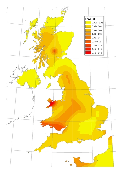
A Revised Seismic Hazard Map for the UK
New seismic hazard maps for the UK have been produced as part of the work involved with the introduction of the Eurocode 8 building regulations. These give guidance on the levels of peak ground acceleration (PGA) to be expected in different parts of the country.
Results
The map shows that the part of the UK with the highest seismic hazard is Snowdonia. This is due to the regular occurrence of significant earthquakes in this area throughout the historical record. The next most hazardous location is South Wales, which has also experienced notable earthquake activity over the last few hundred years.