Summary
| DATE | 21/05/1382 |
| ORIGIN TIME | 15:00:00 UTC |
| LOCATION | 51.340 2.000 |
| DEPTH | 25.0 km |
| MAGNITUDE | 5.8 ML |
| LOCALITY | DOVER STRAITS |
| DATE | 21/05/1382 |
| ORIGIN TIME | 15:00:00 UTC |
| LOCATION | 51.340 2.000 |
| DEPTH | 25.0 km |
| MAGNITUDE | 5.8 ML |
| LOCALITY | DOVER STRAITS |
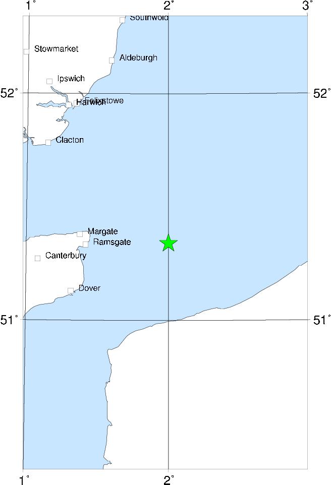

Documentation for this event is quite good, both in England and in the Low Countries, allowing an epicentre in the Dover Straits to be fixed with reasonably certainty. In addition to the usual vague accounts of damage at unamed localities, there are some details of damage at Canterbury and Hollingbourne in Kent, and at London (minor). The earthquake is famous for disrupting a Council meeting in London held to condemn the doctrines of John Wycliffe; both sides claiming the earthquake as a mark of Divine displeasure against the other side. It also inspired an early English poem describing the event:
... Chaumbres, chymeneys, al to-barst,
Chirches and castelles foule gon fare;
Pinacles, steples, to ground hit cast;
And al was for warnyng to be ware.
are the lines describing the damage. The extent to which the earthquake was felt north and west of London (where the intensity was probably 6 MSK) is unknown but was probably extensive, and the magnitude of the earthquake probably exceeded 5� ML.
Sources: Melville (1982), BGS material.