Summary
| DATE | 06/10/1863 |
| ORIGIN TIME | 03:22:00 UTC |
| LOCATION | 52.000 -2.800 |
| DEPTH | 25.0 km |
| MAGNITUDE | 5.2 ML |
| LOCALITY | HEREFORD |
| DATE | 06/10/1863 |
| ORIGIN TIME | 03:22:00 UTC |
| LOCATION | 52.000 -2.800 |
| DEPTH | 25.0 km |
| MAGNITUDE | 5.2 ML |
| LOCALITY | HEREFORD |
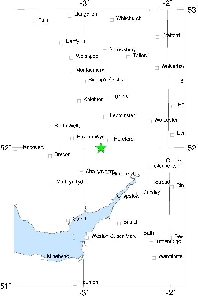

This event is extremely well documented, partly due to a contemporary investigation by EJ Lowe, partly due to the very copious newspaper reports of the event. The epicentre was to the SW of Hereford itself, in the area known as the Golden Valley. Damage in the epicentral area (Hereford - Ross on Wye - Monmouth - Abergavenny - Hay on Wye) was fairly minor, but there are also reports of isolated instances of damage at places further away, including several places in Shropshire and even as far away as Lincoln.
The effects of the shock were felt over almost the whole of England and Wales south of the Lake District (it was felt at Ulverstone), including Cornwall and Kent, where it was felt by Charles Dickens, who described the experience in a letter to the Times. It seems also to have been felt quite noticeably in N France at Le Havre and other places (Vogt 1979), which is unusual; this extends the felt area sufficiently to give the earthquake a magnitude equal to that of the 19 July 1984 Lleyn earthquake.
This may also be one of the last instances in the UK of a religious interpretation being put on an earthquake; on the Sunday following, the vicar of Leominster preached a sermon stating that the earthquake was sent by God as a result of the numbers of Dissenters in the parish, and was widely ridiculed as a result.
Sources: Soil Mechanics (1982), Vogt (1979), BGS material.