Summary
| DATE | 27/06/1906 |
| ORIGIN TIME | 09:45:00 UTC |
| LOCATION | 51.620 -3.810 |
| DEPTH | 13.0 km |
| MAGNITUDE | 5.2 ML |
| LOCALITY | SWANSEA |
| DATE | 27/06/1906 |
| ORIGIN TIME | 09:45:00 UTC |
| LOCATION | 51.620 -3.810 |
| DEPTH | 13.0 km |
| MAGNITUDE | 5.2 ML |
| LOCALITY | SWANSEA |
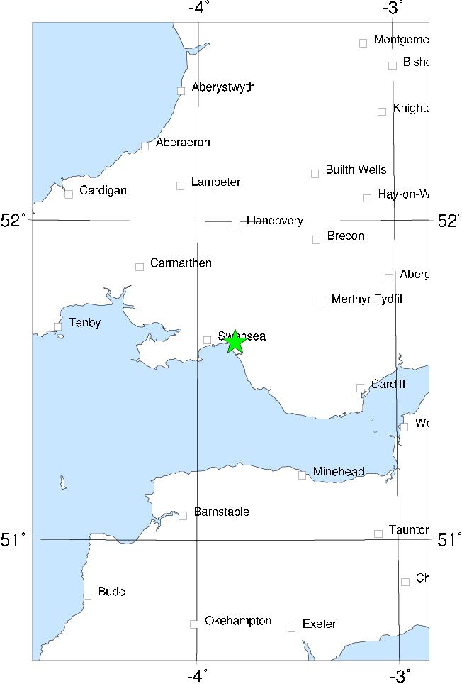

This was one of the most damaging earthquakes in Britain this century. The area where slight damage to chimneys and walls occurred stretches from Kidwelly to Cardiff and inland to Merthyr Tydfil (plus a few more distant reports). Locally within this area intensity 7 MSK was reached, including at Swansea itself, where the damage, especially to chimneys, was considerable. Two people were injured at Swansea. The shock was felt strongly in the mines of the S Wales coalfield, and some pits stopped work for safety checks.
The outer limits of the felt area were Harrogate in the north, Maidenhead (Berks) in the east, Penzance in the south and Waterford in the west. The epicentre was near Swansea, probably offshore. There is a curious lack of aftershocks.
Sources: Musson et al (1984a), instrumental.